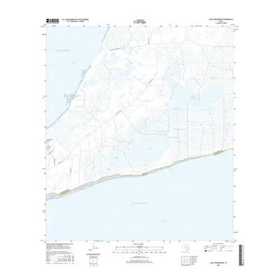
2016 Map of Lake Stephenson
USGS Topo · Published 2016About this map
Lake Stephenson and the surrounding coastal wetlands dominate this 2016 survey along the boundary of Chambers and Galveston Counties. The landscape is a complex network of brackish waters and marshes, featuring Lake Surprise, Wallis Lake, and the expansive Gordy Marsh. These interior waters are separated from the Gulf of Mexico and East Bay by narrow coastal strips, including Stephenson Point. The map reveals the critical transition between land and sea, marked by the Trinity River Channel and the winding course of Lone Oak Bayou. Human presence is largely confined to utility and access routes like Smith Point Rd and Fisherman Rd, leading toward local landmarks such as Frankland Point and the nearby Franklin Cem, providing a precise look at the area's hydrology and sparse coastal infrastructure.
Find a feature on this map
20 named features on this map. Tap any name to fly to it.
Don’t see what you’re looking for? This feature index may not catch every label — zoom into the map to look around manually.
Map Details
Editions of this 2016 Lake Stephenson Map
This is the sole edition of this map. No revisions or reprints were ever made.
Other maps of this area

1931 · Flake
USGS Topo · 1:24,000

1931 · Frozen Point
USGS Topo · 1:24,000

1932 · Bolivar Point
USGS Topo · 1:24,000

1933 · Frozen Point
USGS Topo · 1:31,680

1933 · Caplen
USGS Topo · 1:31,680

1933 · Whites Lake
USGS Topo · 1:31,680

1933 · Smith Point
USGS Topo · 1:31,680

1933 · Bolivar Point
USGS Topo · 1:31,680

1933 · Flake
USGS Topo · 1:31,680

1943 · West of Eagle
USGS Topo · 1:31,680