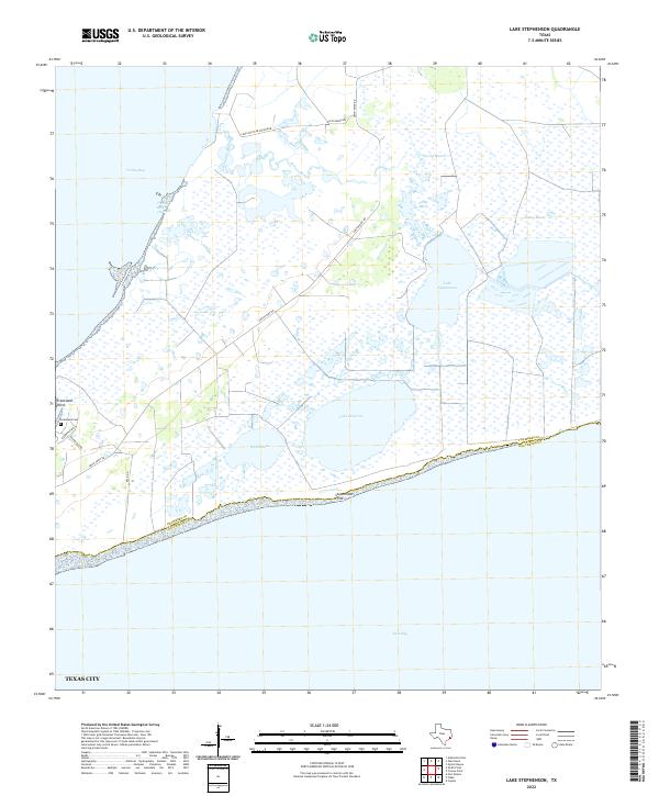
2022 Map of Lake Stephenson
USGS Topo · Published 2022About this map
Trinity Bay and East Bay dominate this coastal landscape, defining a peninsula characterized by extensive wetlands and isolated water bodies. The terrain is a complex network of marshes, including Gordy Marsh and Willow Marsh, which surround significant interior lakes such as Lake Stephenson and Lake Surprise. This environment suggests a region primarily dedicated to conservation, waterfowl habitat, or private recreational use, as evidenced by naming like the Lone Oak Club Private Rd. On the western edge, the small Frankland Cem near Frankland Point provides a specific point of interest for genealogists, marking family history on a coastline where the Chambers Co and Galveston Co line runs along the shore of the East Bay. The map captures the delicate balance between the open waters of the Trinity River Channel and the fragile marshland interior.
Find a feature on this map
20 named features on this map. Tap any name to fly to it.
Don’t see what you’re looking for? This feature index may not catch every label — zoom into the map to look around manually.
Map Details
Editions of this 2022 Lake Stephenson Map
This is the sole edition of this map. No revisions or reprints were ever made.
Other maps of this area

1931 · Flake
USGS Topo · 1:24,000

1931 · Frozen Point
USGS Topo · 1:24,000

1932 · Bolivar Point
USGS Topo · 1:24,000

1933 · Frozen Point
USGS Topo · 1:31,680

1933 · Caplen
USGS Topo · 1:31,680

1933 · Whites Lake
USGS Topo · 1:31,680

1933 · Smith Point
USGS Topo · 1:31,680

1933 · Bolivar Point
USGS Topo · 1:31,680

1933 · Flake
USGS Topo · 1:31,680

1943 · West of Eagle
USGS Topo · 1:31,680