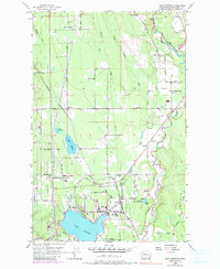
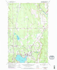
1956 Map of Lake Stevens
USGS Topo · Published 1990About this map
The Lake Stevens shoreline and the surrounding Snohomish County timber and farming lands are documented here in the mid-1950s. The Northern Pacific railroad serves as the primary industrial spine, connecting the small settlements of Getchell, Lochsloy, and Hartford. The latter emerges as a central hub, situated near the north shore of the lake and the southern reach of Little Pilchuck Creek. The presence of several rural institutions, such as the East Sunnyside School, Mt Pilchuck School, and the Granville Grange, indicates a well-established community structure during this era of post-war growth.
Find a feature on this map
49 named features on this map. Tap any name to fly to it.
Don’t see what you’re looking for? This feature index may not catch every label — zoom into the map to look around manually.
Map Details
Editions of this 1956 Lake Stevens Map
5 editions found
Other maps of this area

1895 · Snohomish
USGS Topo · 1:125,000

1897 · Seattle
USGS Topo · 1:125,000

1899 · Stillaguamish
USGS Topo · 1:125,000

1901 · Stilaguamish
USGS Topo · 1:125,000

1911 · Mount Vernon
USGS Topo · 1:125,000

1921 · Sultan
USGS Topo · 1:125,000

1923 · Sultan
USGS Topo · 1:125,000

1941 · Marysville
USGS Topo · 1:62,500

1943 · Marysville
USGS Topo · 1:62,500

1944 · Everett
USGS Topo · 1:62,500