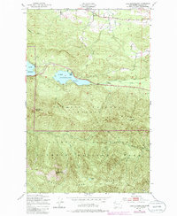
1950 Map of Lake Sutherland
USGS Topo · Published 1985About this map
Lake Sutherland and the eastern edge of Lake Crescent dominate this mid-century topographic record of the northern Olympic Peninsula. The settlement pattern is concentrated along the shorelines and narrow valleys, featuring small communities like Maple Grove and Snug Harbor at the water's edge, and Ramapo situated north of Bear Valley. Transport history is visible through the Old Piedmont Road and a defunct Railroad Grade that skirts the northern hills, hinting at the region's early logging or transit infrastructure before modern highway improvements. South of the lakes, the terrain rises sharply into the protected wilderness of Olympic National Forest and Olympic National Park. This high-elevation country is defined by steep ridges and peaks, including Mount Storm King, Lizard Head Peak, and Mount Baldy, with remote alpine features such as Happy Lake and Stukey Lake tucked into the Happy Lake Ridge.
Find a feature on this map
24 named features on this map. Tap any name to fly to it.
Don’t see what you’re looking for? This feature index may not catch every label — zoom into the map to look around manually.
Map Details
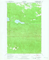
Editions of this 1950 Lake Sutherland Map
3 editions found
Other maps of this area

1918 · Lake Crescent
USGS Topo · 1:62,500

1919 · Port Crescent
USGS Topo · 1:62,500

1922 · Lake Crescent
USGS Topo · 1:62,500

1935 · Mount Olympus
USGS Topo · 1:62,500

1939 · Mount Tom
USGS Topo · 1:62,500

1942 · Mount Olympus
USGS Topo · 1:62,500

1950 · Elwha
USGS Topo · 1:24,000

1950 · Hurricane Hill
USGS Topo · 1:24,000

1950 · Lake Sutherland
USGS Topo · 1:24,000
1950 · Angeles Point
USGS Topo · 1:24,000