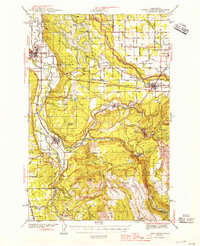
1944 Map of Lake Tapps
USGS Topo · Published 1955About this map
The Carbon River and Puyallup River valleys define this 1940s landscape, where industrial coal mining and agricultural prairies met the emerging power of the Stuck River system. The area around Carbonado and Wilkeson shows a dense network of Coal Mines and quarries, while the lowlands host the sprawling Lake Tapps reservoir and the State Soldiers Home near Orting. Small rural community hubs are clearly marked, including Sunrise Grange Hall, Finnish Hall, and the Kelly Lake Sch. This survey also documents the Muckleshoot Indian Reservation and various pioneer landmarks like the Blockhouse and Monument at Connells Prairie, illustrating the layer of early settlement history beneath the mid-century timber and mining infrastructure. The southern reaches are dominated by the Mt. Rainier Natl. Park Boundary Line and the remote logging operations near Fairfax.
Find a feature on this map
89 named features on this map. Tap any name to fly to it.
Don’t see what you’re looking for? This feature index may not catch every label — zoom into the map to look around manually.
Map Details
Editions of this 1944 Lake Tapps Map
3 editions found
Other maps of this area

1897 · Tacoma
USGS Topo · 1:125,000

1900 · Tacoma
USGS Topo · 1:125,000

1913 · Cedar Lake
USGS Topo · 1:125,000

1924 · Mt Rainier
USGS Topo · 1:96,000

1928 · Mt Rainier
USGS Topo · 1:125,000

1937 · Eatonville
USGS Topo · 1:125,000

1941 · Tanwax Lake
USGS Topo · 1:62,500

1941 · Tacoma South
USGS Topo · 1:62,500

1942 · Lake Tapps
USGS Topo · 1:62,500

1944 · Lake Tapps
USGS Topo · 1:62,500