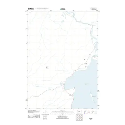
2012 Map of Lake
USGS Topo · Published 2012About this map
The northern shores of Yellowstone Lake define this 2012 survey, where geothermal activity and historic visitor infrastructure converge. Thermal features such as the Mud Volcano, Mud Geyser, and the evocative Black Dragons Caldron are clustered near the banks of the Yellowstone River, illustrating the active geology of the region. The map highlights the core development area at Lake, featuring the Lake Lodge and a Po serving as a central hub for those traveling the Grand Loop Rd. Farther north, the Yellowstone River flows past Nez Perce Ford and the turbulent LeHardys Rapids. Backcountry routes like the Howard Eton Trl wind through the timbered slopes of Elephant Back Mountain, providing a detailed look at the interface between the area's developed corridors and its expansive wilderness.
Find a feature on this map
24 named features on this map. Tap any name to fly to it.
Don’t see what you’re looking for? This feature index may not catch every label — zoom into the map to look around manually.
Map Details
Editions of this 2012 Lake Map
This is the sole edition of this map. No revisions or reprints were ever made.
Other maps of this area

1885 · Lake
USGS Topo · 1:125,000

1885 · Gallatin
USGS Topo · 1:125,000

1885 · Gallatin
USGS Topo · 1:125,000

1886 · Shoshone
USGS Topo · 1:125,000

1886 · Canyon
USGS Topo · 1:125,000

1888 · Shoshone
USGS Topo · 1:125,000

1895 · Shoshone
USGS Topo · 1:125,000

1895 · Canyon
USGS Topo · 1:125,000

1895 · Lake
USGS Topo · 1:125,000

1896 · Lake
USGS Topo · 1:125,000