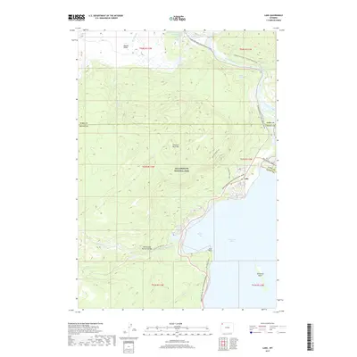
2017 Map of Lake
USGS Topo · Published 2017About this map
Yellowstone Lake defines the southeastern geography of this area, with Bridge Bay providing a protected harbor along the western shoreline. Thermal activity is concentrated to the north near Hayden Valley, where geologic features including Dragons Mouth Spring, Mud Geyser, and the Black Dragons Caldron highlight the unique geothermal character of the region. The map captures the infrastructure of Yellowstone National Park at a time when the Grand Loop Road and Gull Point Drive facilitated access to the water's edge.
Find a feature on this map
36 named features on this map. Tap any name to fly to it.
Don’t see what you’re looking for? This feature index may not catch every label — zoom into the map to look around manually.
Map Details
Editions of this 2017 Lake Map
This is the sole edition of this map. No revisions or reprints were ever made.
Other maps of this area

1885 · Lake
USGS Topo · 1:125,000

1885 · Gallatin
USGS Topo · 1:125,000

1885 · Gallatin
USGS Topo · 1:125,000

1886 · Shoshone
USGS Topo · 1:125,000

1886 · Canyon
USGS Topo · 1:125,000

1888 · Shoshone
USGS Topo · 1:125,000

1895 · Shoshone
USGS Topo · 1:125,000

1895 · Canyon
USGS Topo · 1:125,000

1895 · Lake
USGS Topo · 1:125,000

1896 · Lake
USGS Topo · 1:125,000