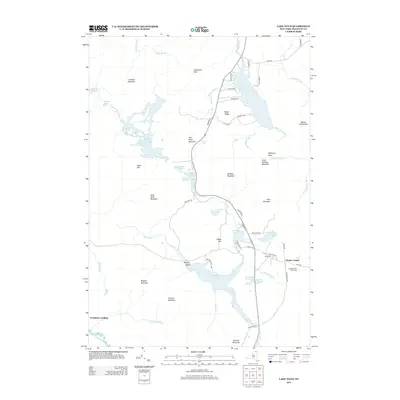
2013 Map of Lake Titus
USGS Topo · Published 2013About this map
Lake Titus dominates the northern reaches of this Adirondack landscape, where the waters of Sycamore Brook and Snake Brook converge before flowing toward the Little Salmon River basin. To the south, the Deer River widens into the Deer River Flow, a significant water body punctuated by Wrights Island. The settlement at Duane Center serves as a local hub near the Ladd Cem and the Harmony Hills Farmstead, illustrating the persistent agricultural and community presence in a region largely defined by its high peaks and drainage systems.
Find a feature on this map
71 named features on this map. Tap any name to fly to it.
Don’t see what you’re looking for? This feature index may not catch every label — zoom into the map to look around manually.
Map Details
Editions of this 2013 Lake Titus Map
This is the sole edition of this map. No revisions or reprints were ever made.
Other maps of this area

1906 · Loon Lake
USGS Topo · 1:62,500

1908 · Loon Lake
USGS Topo · 1:62,500

1915 · Chateaugay
USGS Topo · 1:62,500

1915 · Malone
USGS Topo · 1:62,500

1917 · Malone
USGS Topo · 1:62,500

1921 · Santa Clara
USGS Topo · 1:62,500

1923 · Santa Clara
USGS Topo · 1:62,500

1943 · Chateaugay
USGS Topo · 1:62,500

1948 · Ogdensburg
USGS Topo · 1:250,000

1951 · Ogdensburg
USGS Topo · 1:250,000