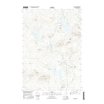
2016 Map of Lake Titus
USGS Topo · Published 2016About this map
The Adirondack Park Preserve defines the character of this Franklin County landscape, where the waters of Lake Titus and the Deer River Flow dominate the central topography. In the southern reaches, the presence of Furnace Mtn and Orebed Mtn speaks to the region's industrial heritage, likely marking sites of nineteenth-century iron extraction and processing. The small settlement at Duane Center remains a focal point near the historic Ladd Cem, while the interior is dotted with numerous high-elevation water bodies like Lake Duane and Lake Frances. This survey captures a network of local roads such as Red Tavern Rd and Co Rte 41 that provide access to the various ridges and peaks, including Titusville Mtn and Catamount Peak, which surround the sprawling valley drainage systems.
Find a feature on this map
72 named features on this map. Tap any name to fly to it.
Don’t see what you’re looking for? This feature index may not catch every label — zoom into the map to look around manually.
Map Details
Editions of this 2016 Lake Titus Map
This is the sole edition of this map. No revisions or reprints were ever made.
Other maps of this area

1906 · Loon Lake
USGS Topo · 1:62,500

1908 · Loon Lake
USGS Topo · 1:62,500

1915 · Chateaugay
USGS Topo · 1:62,500

1915 · Malone
USGS Topo · 1:62,500

1917 · Malone
USGS Topo · 1:62,500

1921 · Santa Clara
USGS Topo · 1:62,500

1923 · Santa Clara
USGS Topo · 1:62,500

1943 · Chateaugay
USGS Topo · 1:62,500

1948 · Ogdensburg
USGS Topo · 1:250,000

1951 · Ogdensburg
USGS Topo · 1:250,000