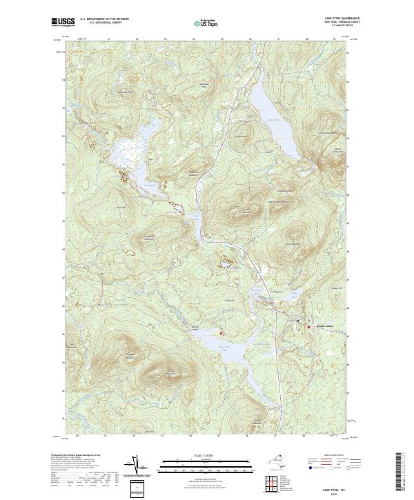
2023 Map of Lake Titus
USGS Topo · Published 2023About this map
Duane Center serves as the quiet geographic anchor for this pocket of the Adirondacks, situated near the intersection of Co Rte 26 and Old Meacham Rd. The landscape is a complex network of high peaks and interconnected water bodies, from the prominent shoreline of Lake Titus in the north to the sprawling Deer River Flow near the center. The presence of Ladd Cem along Old Hogsback Rd provides a specific point of interest for genealogists tracing families in this remote corner of Franklin County. Distinctive terrain features like the steep Elephants Head and the high summit of Titusville Mountain tower over the valleys. The map also reveals the historical footprint of local industry and transit through names like Furnace Mountain and the Deer River Canoe Carry Trl, tracing old routes through the Adirondack Park Preserve.
Find a feature on this map
79 named features on this map. Tap any name to fly to it.
Don’t see what you’re looking for? This feature index may not catch every label — zoom into the map to look around manually.
Map Details
Editions of this 2023 Lake Titus Map
This is the sole edition of this map. No revisions or reprints were ever made.
Other maps of this area

1906 · Loon Lake
USGS Topo · 1:62,500

1908 · Loon Lake
USGS Topo · 1:62,500

1915 · Chateaugay
USGS Topo · 1:62,500

1915 · Malone
USGS Topo · 1:62,500

1917 · Malone
USGS Topo · 1:62,500

1921 · Santa Clara
USGS Topo · 1:62,500

1923 · Santa Clara
USGS Topo · 1:62,500

1943 · Chateaugay
USGS Topo · 1:62,500

1948 · Ogdensburg
USGS Topo · 1:250,000

1951 · Ogdensburg
USGS Topo · 1:250,000