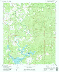
1978 Map of Lake Tuscaloosa North
USGS Topo · Published 1986About this map
The North River meanders through a landscape of deep valleys and winding ridges in the years following the creation of the reservoir. The small community of Samantha serves as the primary hub, situated near the junction of Jasper Road and Moores Bridge Road. The map documents a rural transition as the rising waters of Lake Tuscaloosa North began to fill the lower reaches of tributaries like Bunion Cr and Tierce Creek.
Find a feature on this map
45 named features on this map. Tap any name to fly to it.
Don’t see what you’re looking for? This feature index may not catch every label — zoom into the map to look around manually.
Map Details
Editions of this 1978 Lake Tuscaloosa North Map
3 editions found
Other maps of this area

1893 · Jasper
USGS Topo · 1:125,000

1899 · Brookwood
USGS Topo · 1:125,000

1926 · Samantha
USGS Topo · 1:48,000

1928 · Samantha
USGS Topo · 1:62,500

1929 · Searles
USGS Topo · 1:48,000

1934 · Searles
USGS Topo · 1:62,500

1949 · Wiley
USGS Topo · 1:24,000

1951 · Wiley
USGS Topo · 1:24,000

1953 · Birmingham
USGS Topo · 1:250,000

1956 · Birmingham
USGS Topo · 1:250,000