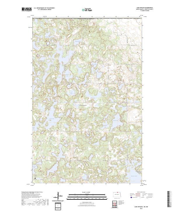
2024 Map of Lake Upsilon
USGS Topo · Published 2024About this map
The Turtle Mountains dominate this borderland landscape, characterized by a dense concentration of glacial lakes and wetlands along the boundary between the United States of America and Canada. Centered on Lake Upsilon, the terrain is defined by a complex network of water bodies including Mill Lake, Boyd Lake, and Desjarlis Lake. The settlement pattern reflects a mix of institutional and recreational land use, featuring the Turtle Mountain Community College near Belcourt Lake in the southeast.
Find a feature on this map
47 named features on this map. Tap any name to fly to it.
Don’t see what you’re looking for? This feature index may not catch every label — zoom into the map to look around manually.
Map Details
Editions of this 2024 Lake Upsilon Map
This is the sole edition of this map. No revisions or reprints were ever made.
Other maps of this area

1936 · Lake Upsilon
USGS Topo · 1:48,000

1942 · Lake Upsilon
USGS Topo · 1:62,500

1953 · Devils Lake
USGS Topo · 1:250,000

1955 · Lake Upsilon SW
USGS Topo · 1:24,000

1956 · Devils Lake
USGS Topo · 1:250,000

1968 · Lake Upsilon SE
USGS Topo · 1:24,000
1968 · Carpenter Lake
USGS Topo · 1:24,000
1968 · Lake Upsilon
USGS Topo · 1:24,000

1968 · Belcourt
USGS Topo · 1:24,000

1969 · Saint John
USGS Topo · 1:24,000