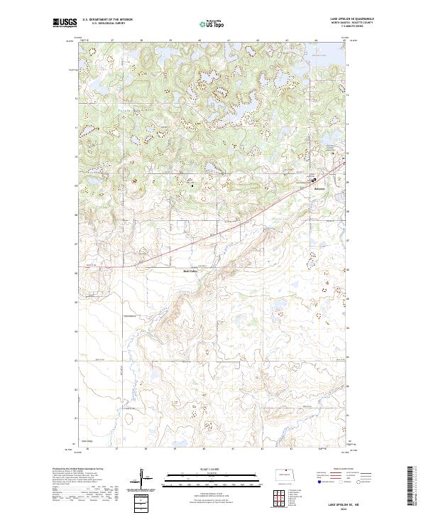
2024 Map of Lake Upsilon SE
USGS Topo · Published 2024About this map
Turtle Mountains dominate the northern landscape of this Rolette County region, where the terrain breaks into a complex pattern of glacial hills and small wetlands. The settlement of Belcourt sits on the eastern edge of the survey, serving as a focal point for local infrastructure alongside Shell Valley to the southwest. This modern mapping captures the area's intricate burial history, documenting multiple distinct sites including Saint Ann Catholic Original Cem, Saint Anns Addition Cem, and the White Stone Cem. Drainage is defined by the winding paths of Wolf Creek and Ox Creek, which flow through a mosaic of protected lands. The presence of the Rolette County Waterfowl Production Area highlights the importance of the local prairie pothole environment, while a network of Bureau of Indian Affairs roads, such as Bia RD 21 and Bia RD 10, connects the scattered farmsteads and communities across the township lines.
Find a feature on this map
32 named features on this map. Tap any name to fly to it.
Don’t see what you’re looking for? This feature index may not catch every label — zoom into the map to look around manually.
Map Details
Editions of this 2024 Lake Upsilon SE Map
This is the sole edition of this map. No revisions or reprints were ever made.
Other maps of this area

1936 · Lake Upsilon
USGS Topo · 1:48,000

1942 · Lake Upsilon
USGS Topo · 1:62,500

1953 · Devils Lake
USGS Topo · 1:250,000

1955 · Thorne
USGS Topo · 1:24,000

1955 · Lake Upsilon SW
USGS Topo · 1:24,000

1956 · Devils Lake
USGS Topo · 1:250,000

1968 · Lake Upsilon SE
USGS Topo · 1:24,000
1968 · Carpenter Lake
USGS Topo · 1:24,000
1968 · Lake Upsilon
USGS Topo · 1:24,000

1968 · Belcourt
USGS Topo · 1:24,000