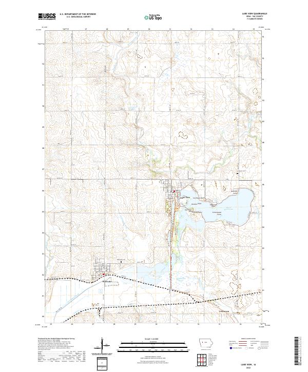
2022 Map of Lake View
USGS Topo · Published 2022About this map
Lake View sits at the heart of this landscape, its residential streets and shoreline developments framing the northern and western reaches of Black Hawk Lake. The map reveals a transition from the structured town grid to the surrounding glacial topography, notably featuring several distinct lakeside points such as Ice House Point, Hunters Point, and Lakewood Point. South of the lake, Black Hawk Marsh and the Wall Lake Inlet highlight a low-lying hydrological network that eventually connects to the Boyer River and Lime Cr.
Find a feature on this map
30 named features on this map. Tap any name to fly to it.
Don’t see what you’re looking for? This feature index may not catch every label — zoom into the map to look around manually.
Map Details
Editions of this 2022 Lake View Map
This is the sole edition of this map. No revisions or reprints were ever made.
Other maps of this area

1954 · Fort Dodge
USGS Topo · 1:250,000

1957 · Fort Dodge
USGS Topo · 1:250,000

1958 · Fort Dodge
USGS Topo · 1:250,000

1980 · Odebolt East
USGS Topo · 1:24,000

1980 · Sac City East
USGS Topo · 1:24,000

1980 · Breda
USGS Topo · 1:24,000

1980 · Grant City
USGS Topo · 1:24,000

1980 · Early
USGS Topo · 1:24,000

1980 · Lake View
USGS Topo · 1:24,000
1980 · Sac City West
USGS Topo · 1:24,000