
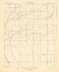
1927 Map of Lake View School
USGS Topo · Published 1927About this map
Hydraulic engineering and agricultural development define this Central Valley landscape in Tulare County. The Tule River and Elk Bayou dominate the drainage pattern, while the presence of the Big Canal and the Taylor Weir indicate the sophisticated water management systems required for the region's farming economy. The infrastructure is further characterized by a rigid grid of rural thoroughfares, including Poplar Avenue and Magomber Road, which segment the territory between the waterways and the Atchison Topeka and Santa Fe railroad line in the southwest corner.
Find a feature on this map
16 named features on this map. Tap any name to fly to it.
Don’t see what you’re looking for? This feature index may not catch every label — zoom into the map to look around manually.
Map Details
Editions of this 1927 Lake View School Map
2 editions found
Other maps of this area

1914 · Lost Hills
USGS Topo · 1:125,000

1925 · Tulare
USGS Topo · 1:31,680

1925 · Tipton
USGS Topo · 1:31,680

1927 · Paige
USGS Topo · 1:31,680

1927 · Tulare
USGS Topo · 1:31,680

1928 · Tipton
USGS Topo · 1:31,680

1928 · Waukena
USGS Topo · 1:31,680

1928 · Corcoran
USGS Topo · 1:31,680

1929 · Alpaugh
USGS Topo · 1:31,680

1929 · Pixley
USGS Topo · 1:31,680