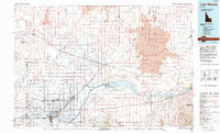
1993 Map of Lake Walcott
USGS Topo · Published 1994About this map
The Snake River corridor defines this South-Central Idaho landscape, where irrigated agricultural lands transition into the stark volcanic geology of the Wapi Lava Flow. In the early 1990s, the region's human geography was anchored by Rupert and Burley, with smaller rail-side settlements like Acequia and Amalga marking the path of the Union Pacific railroad. The map provides a clear look at the intricate network of canals and drains that support the farming communities south of the river near Declo and Springdale.
Find a feature on this map
44 named features on this map. Tap any name to fly to it.
Don’t see what you’re looking for? This feature index may not catch every label — zoom into the map to look around manually.
Map Details
Editions of this 1993 Lake Walcott Map
This is the sole edition of this map. No revisions or reprints were ever made.
Other maps of this area

1934 · American Falls
USGS Topo · 1:62,500

1934 · Rockland
USGS Topo · 1:62,500

1936 · American Falls
USGS Topo · 1:62,500

1937 · Rockland
USGS Topo · 1:62,500

1954 · Pocatello
USGS Topo · 1:250,000

1955 · Idaho Falls
USGS Topo · 1:250,000

1955 · Twin Falls
USGS Topo · 1:250,000

1955 · Hailey
USGS Topo · 1:250,000

1958 · Twin Falls
USGS Topo · 1:250,000

1958 · Idaho Falls
USGS Topo · 1:250,000