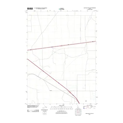
2010 Map of Lake Walcott SW
USGS Topo · Published 2010About this map
Cotterel and the surrounding high desert of Cassia County are captured in this 2010 survey, showcasing the geometric precision of the region's agricultural and transit infrastructure. The landscape is defined by the intersection of modern interstate travel and historical routes, notably the path of the Emigrant Trl which skirts the eastern edge of the map. This area serves as a significant junction where local thoroughfares like E Baseline Rd and N Yale Rd meet the primary transportation corridor. To the south, the solitary rise of Horse Butte stands as a distinct topographic landmark amidst the grid of rural roads, including 2050 E Rd and 1400 E Jensen Rd. The map illustrates the persistent footprint of westward expansion, where the legacy of early trails remains etched alongside contemporary valley development.
Find a feature on this map
8 named features on this map. Tap any name to fly to it.
Don’t see what you’re looking for? This feature index may not catch every label — zoom into the map to look around manually.
Map Details
Editions of this 2010 Lake Walcott SW Map
This is the sole edition of this map. No revisions or reprints were ever made.
Other maps of this area

1954 · Pocatello
USGS Topo · 1:250,000

1958 · Pocatello
USGS Topo · 1:250,000

1959 · Lake Walcott
USGS Topo · 1:62,500

1964 · Rupert SE
USGS Topo · 1:24,000

1964 · Acequia
USGS Topo · 1:24,000

1968 · Malta NE
USGS Topo · 1:24,000

1968 · Idahome
USGS Topo · 1:24,000

1968 · Albion
USGS Topo · 1:24,000
1984 · Lake Walcott West
USGS Topo · 1:24,000
1984 · Lake Walcott SE
USGS Topo · 1:24,000