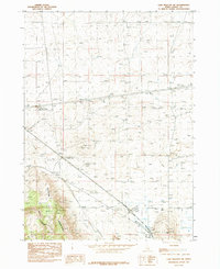
1984 Map of Lake Walcott SW
USGS Topo · Published 1984About this map
The Cotterel Mountains define the high ground of this Cassia County landscape, where the settlement of Cotterel is situated along a network of utility corridors. This 1984 survey highlights a complex infrastructure of transmission lines and a pipeline that crisscross the arid terrain, illustrating the region's role in energy transit during the late 20th century. Historical movement across the land is evident in the presence of the Emigrant Trail (4WD) and an Old Railroad Grade, providing a clear record of how travel and transport evolved from pioneer tracks to iron rails.
Find a feature on this map
19 named features on this map. Tap any name to fly to it.
Don’t see what you’re looking for? This feature index may not catch every label — zoom into the map to look around manually.
Map Details
Editions of this 1984 Lake Walcott SW Map
This is the sole edition of this map. No revisions or reprints were ever made.
Other maps of this area

1954 · Pocatello
USGS Topo · 1:250,000

1958 · Pocatello
USGS Topo · 1:250,000

1959 · Lake Walcott
USGS Topo · 1:62,500

1964 · Rupert SE
USGS Topo · 1:24,000

1964 · Acequia
USGS Topo · 1:24,000

1968 · Malta NE
USGS Topo · 1:24,000

1968 · Idahome
USGS Topo · 1:24,000

1968 · Albion
USGS Topo · 1:24,000
1984 · Lake Walcott West
USGS Topo · 1:24,000
1984 · Lake Walcott SE
USGS Topo · 1:24,000