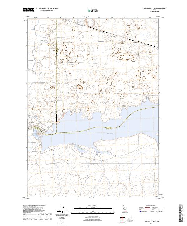
2023 Map of Lake Walcott West
USGS Topo · Published 2023About this map
Lake Walcott dominates the southern landscape of this Idaho quadrangle, where the Snake River is harnessed for regional irrigation. This 2023 survey illustrates the complex boundary intersection of Minidoka, Blaine, and Cassia counties. The northern half of the map is defined by a grid of rural ranch roads, including Main Line Ranch Rd and River Ranch Rd, serving the small settlement of Hawley.
Find a feature on this map
26 named features on this map. Tap any name to fly to it.
Don’t see what you’re looking for? This feature index may not catch every label — zoom into the map to look around manually.
Map Details
Editions of this 2023 Lake Walcott West Map
This is the sole edition of this map. No revisions or reprints were ever made.
Other maps of this area

1954 · Pocatello
USGS Topo · 1:250,000

1958 · Pocatello
USGS Topo · 1:250,000

1959 · Lake Walcott
USGS Topo · 1:62,500

1964 · Rupert SE
USGS Topo · 1:24,000

1964 · Acequia
USGS Topo · 1:24,000

1972 · Schodde Well
USGS Topo · 1:24,000

1972 · Minidoka
USGS Topo · 1:24,000

1972 · Max
USGS Topo · 1:24,000
1984 · Lake Walcott West
USGS Topo · 1:24,000
1984 · Lake Walcott SE
USGS Topo · 1:24,000