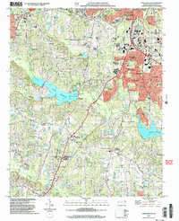
2002 Map of Lake Wheeler
USGS Topo · Published 2004About this map
Lake Wheeler and Lake Benson dominate the central landscape of this Wake County survey, serving as primary hydrologic anchors for the surrounding Piedmont terrain. The area reflects a significant transitional period where established rural communities and agricultural research sites meet the expanding suburban footprints of Raleigh, Cary, and Garner. Notable land use is evidenced by the North Carolina State University Research Units and the historical Yates Millpond, which sits near the Yates Mill Sch. The road network is shaped by several prominent junctions, including McCullers Crossroads and Williams Crossroads. Scattered throughout the rural stretches are numerous family and community landmarks such as Macedonia Cem, Stephens Cem, and the Poplar Springs Ch, providing a detailed record of the local genealogy and settlement patterns that preceded the early 21st-century residential growth seen in developments like Greenbrier Estates and Echo Heights.
Find a feature on this map
63 named features on this map. Tap any name to fly to it.
Don’t see what you’re looking for? This feature index may not catch every label — zoom into the map to look around manually.
Map Details
Editions of this 2002 Lake Wheeler Map
This is the sole edition of this map. No revisions or reprints were ever made.
Other maps of this area

1943 · Durham South
USGS Topo · 1:62,500

1943 · Raleigh
USGS Topo · 1:62,500

1951 · Raleigh
USGS Topo · 1:62,500

1951 · Durham South
USGS Topo · 1:62,500

1953 · Raleigh
USGS Topo · 1:250,000

1954 · Raleigh
USGS Topo · 1:250,000

1964 · Lake Wheeler
USGS Topo · 1:24,000

1964 · Garner
USGS Topo · 1:24,000

1964 · Angier
USGS Topo · 1:24,000

1964 · Edmondson
USGS Topo · 1:24,000