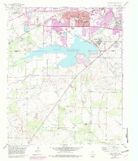
1956 Map of Lake Wichita
USGS Topo · Published 1982About this map
Lake Wichita anchors the landscape south of Wichita Falls, serving as a focal point for the mid-century expansion of Wichita and Archer counties. This 1956 survey, updated with revisions through the early 1980s, documents the sprawling institutional and educational footprint of the era, notably the Midwestern University campus and the sprawling grounds of the Wichita Falls State Hospital. The transition from urban density to rural reaches is marked by the path of the Fort Worth and Denver railroad and several local cemeteries, including Rosemont Cemetery and Crestview Memorial Park Cemetery. To the south, the terrain becomes more sparsely settled, defined by seasonal drainages like Holliday Creek and the presence of the Huff Sch (Aband), which points to a shifting rural school network. The emergence of Lakeside City on the lake's eastern shore highlights the growing residential appeal of the waterfront during this period.
Find a feature on this map
27 named features on this map. Tap any name to fly to it.
Don’t see what you’re looking for? This feature index may not catch every label — zoom into the map to look around manually.
Map Details
Editions of this 1956 Lake Wichita Map
3 editions found
Other maps of this area

1916 · Iowa Park
USGS Topo · 1:24,000

1918 · Iowa Park
USGS Topo · 1:31,680

1931 · Archer City
USGS Topo · 1:62,500

1954 · Wichita Falls
USGS Topo · 1:250,000

1956 · Sloop Creek
USGS Topo · 1:24,000

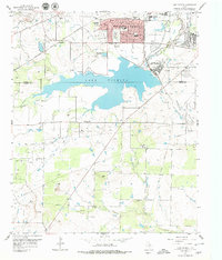
1956 · Lake Wichita
USGS Topo · 1:24,000

1957 · Wichita Falls West
USGS Topo · 1:24,000

1957 · Wichita Falls East
USGS Topo · 1:62,500

1957 · Wichita Falls East
USGS Topo · 1:24,000

1957 · Wichita Falls West
USGS Topo · 1:62,500