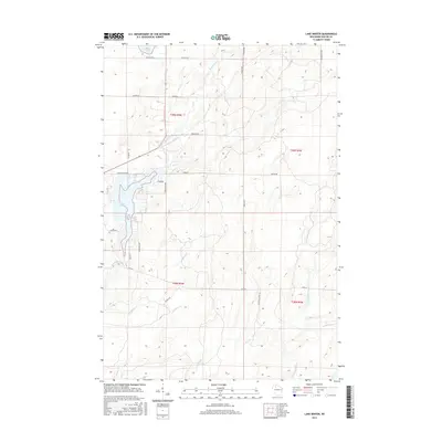
2015 Map of Lake Winter
USGS Topo · Published 2015About this map
Lake Winter and the surrounding Sawyer County wetlands dominate this landscape, showing a complex network of glacial hydrology and managed timberlands. The Brunet River meanders from the north, feeding into the lake near Dam Rd, while the Thornapple River carves through the southeastern corner. This area is characterized by its dense distribution of family-named roads, such as Hanson Rd, Olson Rd, and Sundling Rd, which provide access to the various tributaries including Deadman Cr and Tupper Cr. The presence of these named thoroughfares amidst the creek systems reflects a long-standing history of local land use and rural settlement patterns. In the north, Barber Lake and Island Cr highlight the water-rich environment that has defined the region's character for generations of residents and visitors alike.
Find a feature on this map
37 named features on this map. Tap any name to fly to it.
Don’t see what you’re looking for? This feature index may not catch every label — zoom into the map to look around manually.
Map Details
Editions of this 2015 Lake Winter Map
This is the sole edition of this map. No revisions or reprints were ever made.
Other maps of this area

1944 · Exeland
USGS Topo · 1:48,000

1944 · Draper
USGS Topo · 1:48,000

1944 · Radisson
USGS Topo · 1:48,000

1945 · Ingram
USGS Topo · 1:48,000

1947 · Exeland
USGS Topo · 1:48,000

1947 · Ingram
USGS Topo · 1:48,000

1947 · Draper
USGS Topo · 1:48,000

1949 · Radisson
USGS Topo · 1:48,000

1953 · Rice Lake
USGS Topo · 1:250,000

1959 · Rice Lake
USGS Topo · 1:250,000