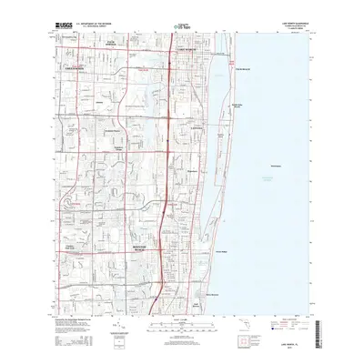
2015 Map of Lake Worth
USGS Topo · Published 2015About this map
Boynton Beach and the surrounding Gold Coast communities are defined by the linear orientation of the Intracoastal Waterway and the barrier islands separating the mainland from the Atlantic Ocean. This survey highlights the dense development patterns along the coast, where municipalities like Lantana, Hypoluxo, and Ocean Ridge occupy the narrow strip between the lagoons and the sea. The interior landscape is shaped by water management and transit, including the Boynton Canal, the Fec railroad corridor, and substantial bodies like Lake Osborne. Notable local landmarks include the Palm Beach County Park Airport and Palm Beach Community Coll, reflecting the area's mid-century growth into a major residential and educational hub. For genealogists and local historians, the map identifies specific community footprints such as Seminole Manor and Hypoluxo Village, alongside resting places like Lincoln Memorial Gardens and Palm Beach Memorial Park.
Find a feature on this map
40 named features on this map. Tap any name to fly to it.
Don’t see what you’re looking for? This feature index may not catch every label — zoom into the map to look around manually.
Map Details
Editions of this 2015 Lake Worth Map
This is the sole edition of this map. No revisions or reprints were ever made.
Other maps of this area

1945 · Greenacres City
USGS Topo · 1:24,000

1945 · Lake Worth
USGS Topo · 1:24,000

1946 · Palm Beach Farms
USGS Topo · 1:24,000

1946 · Palm Beach
USGS Topo · 1:24,000

1947 · Delmar Farms
USGS Topo · 1:24,000

1949 · Lake Worth
USGS Topo · 1:24,000

1949 · Palm Beach Farms
USGS Topo · 1:24,000

1949 · Delmar Farms
USGS Topo · 1:24,000

1950 · Delray Beach
USGS Topo · 1:24,000

1950 · Greenacres City
USGS Topo · 1:24,000