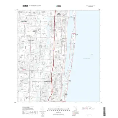
2018 Map of Lake Worth
USGS Topo · Published 2018About this map
Lake Worth and Boynton Beach anchor this coastal survey, where the intricate barrier island geography is defined by the Intracoastal Waterway and the Atlantic Ocean. The landscape transitions from the dense residential developments of Palm Springs and Lantana to the water-dominated environments of Lake Osborne and the Boynton Canal. Of particular interest to local historians is the Fec RR corridor, which runs parallel to the coast through these established communities, and the Boynton Inlet providing a critical passage to the sea. Educational and civic landmarks like Palm Beach State College and the Palm Beach County Park Airport are prominent, alongside smaller residential enclaves such as San Castle and Briny Breezes. The map captures the modern layout of the region, featuring major arteries like Lake Worth Rd and the prominent Harris Bridge connecting the mainland to the exclusive reaches of Manalapan.
Find a feature on this map
38 named features on this map. Tap any name to fly to it.
Don’t see what you’re looking for? This feature index may not catch every label — zoom into the map to look around manually.
Map Details
Editions of this 2018 Lake Worth Map
This is the sole edition of this map. No revisions or reprints were ever made.
Other maps of this area

1945 · Greenacres City
USGS Topo · 1:24,000

1945 · Lake Worth
USGS Topo · 1:24,000

1946 · Palm Beach Farms
USGS Topo · 1:24,000

1946 · Palm Beach
USGS Topo · 1:24,000

1947 · Delmar Farms
USGS Topo · 1:24,000

1949 · Lake Worth
USGS Topo · 1:24,000

1949 · Palm Beach Farms
USGS Topo · 1:24,000

1949 · Delmar Farms
USGS Topo · 1:24,000

1950 · Delray Beach
USGS Topo · 1:24,000

1950 · Greenacres City
USGS Topo · 1:24,000