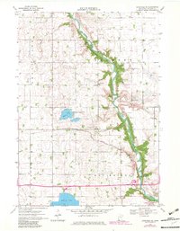
1970 Map of Lakefield NE
USGS Topo · Published 1982About this map
The Des Moines River meanders through a landscape defined by industrial agriculture and conservation efforts in southern Minnesota. The rugged river valley is home to Kilen Woods State Park, offering a stark contrast to the surrounding grid of section lines and extensive drainage systems like Judicial Ditch No 37. Evidence of the area's spiritual and social history is found in local landmarks like Belmont Ch and the neighboring West Belmont Cem.
Find a feature on this map
28 named features on this map. Tap any name to fly to it.
Don’t see what you’re looking for? This feature index may not catch every label — zoom into the map to look around manually.
Map Details
Editions of this 1970 Lakefield NE Map
2 editions found
Other maps of this area

1954 · Fairmont
USGS Topo · 1:250,000

1958 · Fairmont
USGS Topo · 1:250,000

1970 · Jackson NW
USGS Topo · 1:24,000

1970 · Lakefield SW
USGS Topo · 1:24,000

1970 · Lakefield NE
USGS Topo · 1:24,000

1970 · Jackson
USGS Topo · 1:24,000

1970 · Wilder
USGS Topo · 1:24,000

1970 · Lakefield SE
USGS Topo · 1:24,000

1970 · Lakefield
USGS Topo · 1:24,000

1970 · Windom
USGS Topo · 1:24,000