
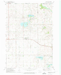
1970 Map of Lakefield SE
USGS Topo · Published 1972About this map
Jackson anchors the northeastern corner of this 1970 survey, where the community infrastructure includes a Hospital, Nursing Home, and a Vocational Sch. The landscape is defined by the transition between Minnesota and Iowa, featuring a complex network of man-made waterways like Judicial Ditch No 35 and Judicial Ditch No 61 that drain the fertile agricultural plains of Hunter and Des Moines townships.
Find a feature on this map
30 named features on this map. Tap any name to fly to it.
Don’t see what you’re looking for? This feature index may not catch every label — zoom into the map to look around manually.
Map Details
Editions of this 1970 Lakefield SE Map
This is the sole edition of this map. No revisions or reprints were ever made.
Other maps of this area

1954 · Fairmont
USGS Topo · 1:250,000

1958 · Fairmont
USGS Topo · 1:250,000

1970 · Jackson NW
USGS Topo · 1:24,000

1970 · Lakefield SW
USGS Topo · 1:24,000

1970 · Lakefield NE
USGS Topo · 1:24,000

1970 · Jackson
USGS Topo · 1:24,000

1970 · Okoboji
USGS Topo · 1:24,000

1970 · Lakefield
USGS Topo · 1:24,000

1970 · Spirit Lake
USGS Topo · 1:24,000
1972 · Superior
USGS Topo · 1:24,000