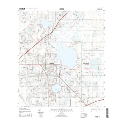
2015 Map of Lakeland
USGS Topo · Published 2015About this map
The cityscape of Lakeland is defined by its remarkable density of freshwater bodies, with the residential and institutional life of the city closely tied to its lakeshores. Florida Southern College and Southeastern University sit prominently near the water, while the downtown area is framed by Lake Mirror, Lake Morton, and Lake Wire. The surrounding geography includes established neighborhoods like Gibsonia, Griffin, and Combee Settlement, alongside industrial and transit corridors such as Interstate 4 and the CSX Transportation railroad line.
Find a feature on this map
60 named features on this map. Tap any name to fly to it.
Don’t see what you’re looking for? This feature index may not catch every label — zoom into the map to look around manually.
Map Details
Editions of this 2015 Lakeland Map
This is the sole edition of this map. No revisions or reprints were ever made.
Other maps of this area

1944 · Plant City
USGS Topo · 1:31,680

1944 · Providence
USGS Topo · 1:31,680

1944 · Polk City
USGS Topo · 1:31,680

1944 · Lakeland
USGS Topo · 1:31,680

1944 · Auburndale
USGS Topo · 1:31,680

1944 · Socrum
USGS Topo · 1:31,680

1949 · Mulberry
USGS Topo · 1:24,000

1949 · Bartow
USGS Topo · 1:24,000

1950 · Mulberry
USGS Topo · 1:24,000

1950 · Bartow
USGS Topo · 1:24,000