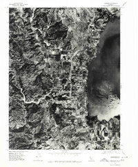
1977 Map of Lakeport
USGS Topo · Published 1980About this map
Lakeport sits along the western shoreline of Clear Lake in this 1977 orthophotoquad, revealing a landscape defined by the interface of water, agriculture, and rising terrain. The aerial imagery captures the town's grid and development concentrated near the shore, while the interior is dominated by the winding course of Scotts Creek and a patchwork of orchard-like agricultural plots. To the west, the topography climbs sharply toward Lakeport Peak, marking the transition from the lakeside flats to the upland ridges. This specific aerial survey provides a rare visual record of the shoreline before later modern developments, showing the exact configuration of Rocky Pt and the surrounding hillsides just as they appeared in the late 1970s.
Find a feature on this map
5 named features on this map. Tap any name to fly to it.
Don’t see what you’re looking for? This feature index may not catch every label — zoom into the map to look around manually.
Map Details
Editions of this 1977 Lakeport Map
2 editions found
Other maps of this area

1920 · Ukiah
USGS Topo · 1:62,500

1921 · Kelseyville
USGS Topo · 1:62,500

1938 · Lakeport
USGS Topo · 1:62,500

1938 · Hopland
USGS Topo · 1:62,500

1943 · Kelseyville
USGS Topo · 1:62,500

1943 · Hopland
USGS Topo · 1:62,500

1944 · Ukiah
USGS Topo · 1:62,500

1944 · Hopland
USGS Topo · 1:62,500

1947 · Santa Rosa
USGS Topo · 1:250,000

1949 · Santa Rosa
USGS Topo · 1:250,000