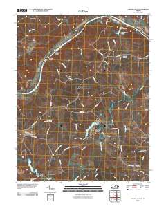
2010 Map of Lakeside Village
USGS Topo · Published 2010About this map
James River frontage and interior timberlands define this portion of Fluvanna County at the turn of the 21st century. The river landscape is punctuated by significant landforms such as Elk Island, Spicers Island, and Boatwrights Island, while the inland area is drained by a dense network of watercourses including the Willis River and Big Cattail Creek. Several rural community centers anchor the local geography, most notably Lakeside Village near Trice Lake and the settlement of Hamilton to the east.
Find a feature on this map
51 named features on this map. Tap any name to fly to it.
Don’t see what you’re looking for? This feature index may not catch every label — zoom into the map to look around manually.
Map Details
Editions of this 2010 Lakeside Village Map
This is the sole edition of this map. No revisions or reprints were ever made.
Other maps of this area

1891 · Palmyra
USGS Topo · 1:125,000

1895 · Palmyra
USGS Topo · 1:125,000

1897 · Palmyra
USGS Topo · 1:125,000

1943 · Scottsville
USGS Topo · 1:62,500

1946 · Scottsville
USGS Topo · 1:62,500

1947 · Roanoke
USGS Topo · 1:250,000

1950 · Dillwyn
USGS Topo · 1:62,500

1958 · Dillwyn
USGS Topo · 1:62,500

1959 · Roanoke
USGS Topo · 1:250,000

1960 · Columbia
USGS Topo · 1:62,500