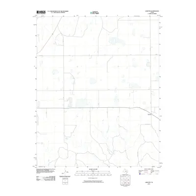
2010 Map of Laketon
USGS Topo · Published 2010About this map
Laketon sits in the southeastern portion of this Texas Panhandle landscape, where the high plains meet the headwaters of the Cantonment Creek drainage system. The settlement pattern is defined by a rigid section-line road grid, including routes like Gray 8 Rd and Gray 21 Rd, which carve the terrain into vast agricultural blocks. The southern half of the map shows the transition from flat upland fields to the more textured topography surrounding the creek bed. This 2010 survey illustrates the modern rural infrastructure of Gray County, anchored by state and county thoroughfares such as F M 748 and Grey Co 26 Rd. The distribution of scattered structures along these roads reflects the enduring agricultural character of the region, while the natural drainage of Cantonment Creek provides a stark contrast to the engineered precision of the surrounding transport network.
Find a feature on this map
14 named features on this map. Tap any name to fly to it.
Don’t see what you’re looking for? This feature index may not catch every label — zoom into the map to look around manually.
Map Details
Editions of this 2010 Laketon Map
This is the sole edition of this map. No revisions or reprints were ever made.
Other maps of this area

1954 · Amarillo
USGS Topo · 1:250,000

1958 · Amarillo
USGS Topo · 1:250,000

1962 · Pond Creek
USGS Topo · 1:24,000

1962 · Pond Creek NW
USGS Topo · 1:24,000

1966 · Laketon
USGS Topo · 1:24,000

1967 · Lefors
USGS Topo · 1:24,000

1967 · Hoover
USGS Topo · 1:24,000

1967 · Tody School
USGS Topo · 1:24,000

1967 · Lora
USGS Topo · 1:24,000

1972 · Pampa NE
USGS Topo · 1:24,000