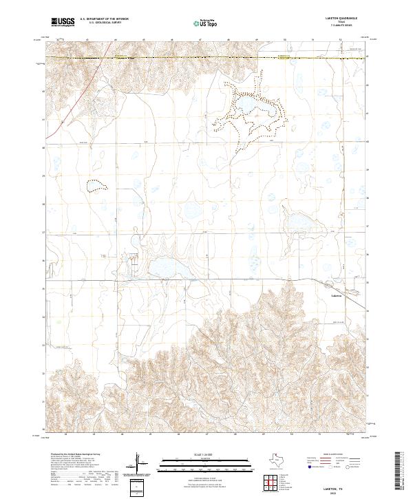
2022 Map of Laketon
USGS Topo · Published 2022About this map
Laketon serves as the primary focal point in this portion of the Texas Panhandle, situated where the high plains begin to break into the complex drainage of the Cantonment Cr system. The map documents the boundary between Roberts Co and Gray Co, showing a landscape defined by an extensive grid of section roads and cattle-ranching infrastructure. Modern corridors like Ranch Rd 1268 and FM 748 connect isolated homesteads and ranching operations across the northern plains. To the south, the terrain shifts dramatically from flat agricultural land into a labyrinth of erosion-carved draws and ridges. Local transit is traced through specifically named routes such as Lindel Dairy Rd and Sante Fe Rd, reflecting the area's agricultural identity and its long-standing connection to regional transportation networks.
Find a feature on this map
15 named features on this map. Tap any name to fly to it.
Don’t see what you’re looking for? This feature index may not catch every label — zoom into the map to look around manually.
Map Details
Editions of this 2022 Laketon Map
This is the sole edition of this map. No revisions or reprints were ever made.
Other maps of this area

1954 · Amarillo
USGS Topo · 1:250,000

1958 · Amarillo
USGS Topo · 1:250,000

1962 · Pond Creek
USGS Topo · 1:24,000

1962 · Pond Creek NW
USGS Topo · 1:24,000

1966 · Laketon
USGS Topo · 1:24,000

1967 · Lefors
USGS Topo · 1:24,000

1967 · Hoover
USGS Topo · 1:24,000

1967 · Tody School
USGS Topo · 1:24,000

1967 · Lora
USGS Topo · 1:24,000

1972 · Pampa NE
USGS Topo · 1:24,000