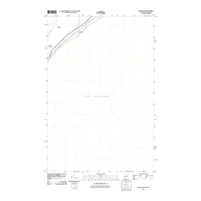
2010 Map of Lakewood
USGS Topo · Published 2010About this map
The vast expanse of Lake Superior dominates this portion of the North Shore, where the shoreline and the rising terrain of Moose Mountain meet. In this 2010 USGS update, the small settlement of Lakewood is centered along the primary coastal transit corridor. Modern infrastructure follows the natural contours of the land, with Congdon Blvd tracing the lakeshore while Lester River Rd and Lakewood Rd move inland toward the heights. The Lester Park Municipal Golf Course serves as a significant recreational landmark on the southwestern edge of the quadrangle, illustrating the suburban development patterns of Duluth as they extend toward the wooded slopes overlooking the water.
Find a feature on this map
7 named features on this map. Tap any name to fly to it.
Don’t see what you’re looking for? This feature index may not catch every label — zoom into the map to look around manually.
Map Details
Editions of this 2010 Lakewood Map
This is the sole edition of this map. No revisions or reprints were ever made.
Other maps of this area

1895 · Duluth
USGS Topo · 1:62,500

1915 · Superior
USGS Topo · 1:48,000

1917 · Superior
USGS Topo · 1:62,500

1949 · Poplar
USGS Topo · 1:48,000

1953 · Lakewood
USGS Topo · 1:24,000

1953 · French River
USGS Topo · 1:24,000

1953 · Arnold
USGS Topo · 1:24,000

1953 · Duluth
USGS Topo · 1:24,000

1953 · Knife River
USGS Topo · 1:24,000

1953 · Duluth
USGS Topo · 1:62,500