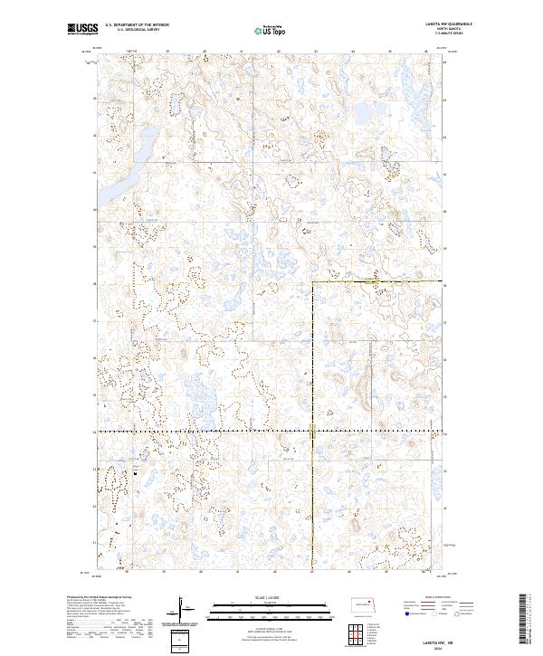
2024 Map of Lakota NW
USGS Topo · Published 2024About this map
The Ramsey County Waterfowl Production Area dominates the central landscape of this North Dakota prairie region, bridging the boundary between Ramsey and Nelson counties. This environment is characterized by a dense network of small wetlands and depressions typical of the drift prairie, intersected by a strict grid of section-line roads such as 57th St NE and 102nd Ave NE. This geometry reflects the enduring influence of the Public Land Survey System on the rural Dakota landscape.
Find a feature on this map
22 named features on this map. Tap any name to fly to it.
Don’t see what you’re looking for? This feature index may not catch every label — zoom into the map to look around manually.
Map Details
Editions of this 2024 Lakota NW Map
This is the sole edition of this map. No revisions or reprints were ever made.
Other maps of this area

1953 · Devils Lake
USGS Topo · 1:250,000

1956 · Devils Lake
USGS Topo · 1:250,000

1970 · Lakota
USGS Topo · 1:24,000
1970 · Bartlett
USGS Topo · 1:24,000

1971 · Brocket
USGS Topo · 1:24,000

1971 · Southam
USGS Topo · 1:24,000
1971 · Doyon
USGS Topo · 1:24,000

1971 · Lakota NW
USGS Topo · 1:24,000

1972 · Derrick SE
USGS Topo · 1:24,000

1972 · Edmore SW
USGS Topo · 1:24,000