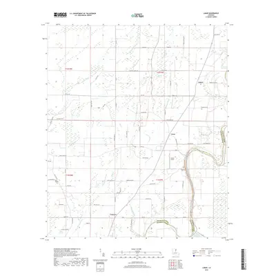
2018 Map of Lamar
USGS Topo · Published 2018About this map
Bayou Macon defines the eastern boundary of this Delta landscape, winding along the border between Franklin and Madison Parishes. The small settlements of Lamar and Bakers occupy the higher ground east of the extensive wetland networks of Hurricane Slough and Martin Slough. The area is characterized by its complex hydrology, where sluggish waterways like Rowing Bayou and Frog Island Slough dictate the placement of roads and farms. To the south, Longview sits near the confluence of local drainages, while the Friendship Cem and Oligrow Airport serve as central community landmarks. The map details a transition from the lower bayou country to the elevation of Hill Ridge, illustrating how the agricultural layout follows the subtle natural rises in this water-dominated environment.
Find a feature on this map
72 named features on this map. Tap any name to fly to it.
Don’t see what you’re looking for? This feature index may not catch every label — zoom into the map to look around manually.
Map Details
Editions of this 2018 Lamar Map
This is the sole edition of this map. No revisions or reprints were ever made.
Other maps of this area

1935 · Winnsboro
USGS Topo · 1:62,500

1935 · Baskinton
USGS Topo · 1:62,500

1935 · Waverly
USGS Topo · 1:62,500

1935 · Shackleford Lake
USGS Topo · 1:62,500

1955 · Jackson
USGS Topo · 1:250,000

1958 · Baskinton
USGS Topo · 1:62,500

1958 · Shackleford Lake
USGS Topo · 1:62,500

1958 · Winnsboro
USGS Topo · 1:62,500

1961 · Jackson
USGS Topo · 1:250,000

1961 · Waverly
USGS Topo · 1:62,500