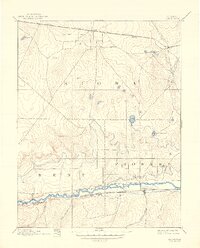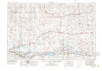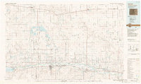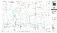
1984 Map of Lamar
USGS Topo · Published 1985About this map
The Arkansas River corridor serves as the primary axis of settlement in this mid-1980s look at Southeastern Colorado and the Kansas border. This high-plains landscape is defined by the intersection of water management and rail transportation, with the Atchison Topeka and Santa Fe line paralleling the river through Lamar, Granada, and Holly. To the north, the Missouri Pacific railroad anchors a string of smaller prairie communities like Eads, Chivington, and Sheridan Lake. The region's agricultural and industrial base is evident in the extensive canal systems, such as the Amity Canal, and the presence of the Brandon Oil Field. Large-scale water storage projects, including the Nee Noshe Reservoir and the John Martin Reservoir, highlight the critical role of irrigation and flood control in sustaining these High Plains townships.
Find a feature on this map
65 named features on this map. Tap any name to fly to it.
Don’t see what you’re looking for? This feature index may not catch every label — zoom into the map to look around manually.
Map Details
Editions of this 1984 Lamar Map
This is the sole edition of this map. No revisions or reprints were ever made.
Historical Maps of Lamar Through Time
5 maps found