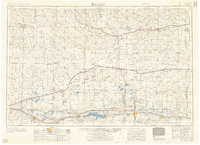
1958 Map of Lamar
USGS Topo · Published 1958About this map
The Arkansas River corridor defines the southern landscape of this mid-century survey, supporting a string of agricultural and rail-oriented settlements. Major water management projects dominate the terrain, notably the massive John Martin Reservoir and a system of canals like the Amity Canal that diverted river water to sustain the valley. This era reveals a transition in military land use, marking the location of Camp Amache (Distroyed) near Granada and the Arlington Air Force (abandoned) field farther north.
Find a feature on this map
63 named features on this map. Tap any name to fly to it.
Don’t see what you’re looking for? This feature index may not catch every label — zoom into the map to look around manually.
Map Details
Editions of this 1958 Lamar Map
2 editions found

Other maps of this area

1889 · Sanborn
USGS Topo · 1:125,000

1890 · Granada
USGS Topo · 1:125,000

1891 · Sanborn
USGS Topo · 1:125,000

1891 · Catlin
USGS Topo · 1:125,000

1891 · Arroyo
USGS Topo · 1:125,000

1891 · Albany
USGS Topo · 1:125,000

1891 · Kit Carson
USGS Topo · 1:125,000

1891 · Higbee
USGS Topo · 1:125,000

1891 · Las Animas
USGS Topo · 1:125,000

1891 · Timpas
USGS Topo · 1:125,000