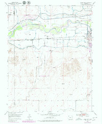
1952 Map of Lamar West
USGS Topo · Published 1979About this map
The Arkansas River corridor defines this portion of Prowers County, where the valley's irrigation infrastructure meets the historic path of the Old Santa Fe Trail. Near the city of Lamar, the landscape is shaped by an extensive network of waterways including the Amity Canal, Fort Bent Canal, and the Vista Del Rio Ditch, all supported by the Lamar Canal Diversion Dam. These systems converted the high plains into productive land, flanked by the riparian woodland of Big Timbers. Local history is anchored by rural institutions such as the Dry Creek School and Riverview Church, while the Atchison Topeka and Santa Fe railway tracks run parallel to the river. The survey also captures the Lamar Municipal Airport and a National Guard Rifle Range, reflecting the mid-century development of the regional hub.
Find a feature on this map
22 named features on this map. Tap any name to fly to it.
Don’t see what you’re looking for? This feature index may not catch every label — zoom into the map to look around manually.
Map Details
Editions of this 1952 Lamar West Map
4 editions found
Other maps of this area

1892 · Lamar
USGS Topo · 1:125,000

1892 · Two Butte
USGS Topo · 1:125,000

1893 · Two Butte
USGS Topo · 1:125,000

1952 · Lamar West
USGS Topo · 1:24,000

1953 · Lamar East
USGS Topo · 1:24,000

1953 · Prowers
USGS Topo · 1:24,000

1954 · Lamar
USGS Topo · 1:250,000

1955 · McClave
USGS Topo · 1:24,000

1955 · May Valley
USGS Topo · 1:24,000

1955 · Wiley
USGS Topo · 1:24,000