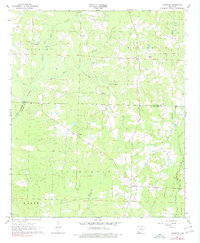
1968 Map of Lamartine
USGS Topo · Published 1979About this map
Willisville Oil Field dominates the northern landscape of this survey, marking a period of petroleum development along the border of Nevada and Columbia counties. The terrain is defined by the winding course of Dorcheat Bayou and Big Creek, where the land transitions into named bottomlands like Alabama Bottom and Taylor. These drainage patterns influenced the placement of early rural settlements and religious centers that served the surrounding farmsteads.
Find a feature on this map
32 named features on this map. Tap any name to fly to it.
Don’t see what you’re looking for? This feature index may not catch every label — zoom into the map to look around manually.
Map Details
Editions of this 1968 Lamartine Map
2 editions found
Other maps of this area

1901 · Gurdon
USGS Topo · 1:125,000

1953 · El Dorado
USGS Topo · 1:250,000

1957 · El Dorado
USGS Topo · 1:250,000

1958 · El Dorado
USGS Topo · 1:250,000

1960 · El Dorado
USGS Topo · 1:250,000

1968 · Buckner
USGS Topo · 1:24,000

1968 · Lamartine
USGS Topo · 1:24,000
1968 · Falcon
USGS Topo · 1:24,000

1968 · Waldo
USGS Topo · 1:24,000
1968 · Magnolia
USGS Topo · 1:24,000