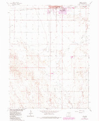
1963 Map of Lamb
USGS Topo · Published 1984About this map
Industrial and agricultural development define this Colorado landscape as it transitioned from the early 1960s into the 1980s. The northern edge of the map features the expanding reach of Fort Morgan, where City Hall and an organized street grid give way to the sprawling infrastructure of the Fort Morgan Oil Field. This area is dense with Oil Wells, Gas Wells, and a dedicated Gasoline Plant, reflecting the region's mid-century energy production.
Find a feature on this map
16 named features on this map. Tap any name to fly to it.
Don’t see what you’re looking for? This feature index may not catch every label — zoom into the map to look around manually.
Map Details
Editions of this 1963 Lamb Map
3 editions found
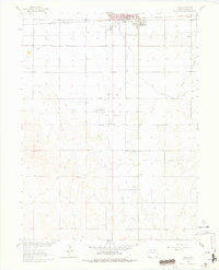
Other maps of this area

1951 · Weldona
USGS Topo · 1:24,000

1951 · Brush West
USGS Topo · 1:24,000

1951 · Fort Morgan
USGS Topo · 1:24,000

1954 · Sterling
USGS Topo · 1:250,000

1958 · Sterling
USGS Topo · 1:250,000

1963 · Lamb
USGS Topo · 1:24,000

1963 · Round Top
USGS Topo · 1:24,000

1963 · Vallery
USGS Topo · 1:24,000

1963 · Adena
USGS Topo · 1:24,000

1965 · Vallery SE
USGS Topo · 1:24,000