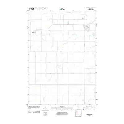
2010 Map of Lamberton
USGS Topo · Published 2010About this map
Lamberton and Revere serve as the primary hubs of this agricultural landscape in Redwood County, situated along the east-west corridor of the regional highway system. The town of Lamberton is centered near the Lamberton Post Office, while the smaller community of Revere lies to the west, marked by the Revere Post Office. The township layout is defined by a rigid grid of numbered roads and named avenues, such as Grandview Ave and Harvest Ave, which intersect the natural drainage patterns of the prairie. The Cottonwood River meanders across the northern portion of the map, fed by several significant tributaries including Pell Creek, Dutch Charley Creek, and Highwater Creek. These waterways provide the only break in the geometric regularity of the farmland, where local history is anchored by sites like Saint Joseph Cemetery and Highwater Cemetery.
Find a feature on this map
39 named features on this map. Tap any name to fly to it.
Don’t see what you’re looking for? This feature index may not catch every label — zoom into the map to look around manually.
Map Details
Editions of this 2010 Lamberton Map
This is the sole edition of this map. No revisions or reprints were ever made.
Other maps of this area

1953 · New Ulm
USGS Topo · 1:250,000

1957 · New Ulm
USGS Topo · 1:250,000

1958 · New Ulm
USGS Topo · 1:250,000

1967 · New Ulm
USGS Topo · 1:250,000

1967 · Wanda
USGS Topo · 1:24,000

1967 · Sanborn
USGS Topo · 1:24,000

1967 · Wabasso SE
USGS Topo · 1:24,000

1967 · Walnut Grove
USGS Topo · 1:24,000

1967 · Storden
USGS Topo · 1:24,000

1967 · Jeffers
USGS Topo · 1:24,000