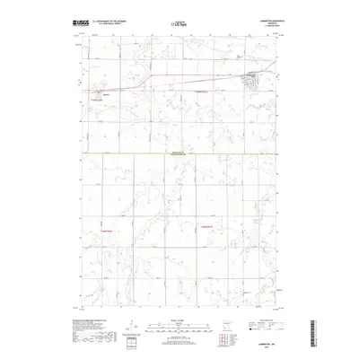
2019 Map of Lamberton
USGS Topo · Published 2019About this map
The Cottonwood River flows across the northern portion of this landscape, anchoring a region defined by agricultural surveying and small-town development at the border of Redwood Co and Cottonwood Co. The village of Lamberton serves as the primary hub, showing a detailed grid of streets including Broadway St, S Main St, and several numbered avenues. To the west, the smaller settlement of Revere sits along the corridor of Co Rd 50. Local history and genealogy researchers can locate several significant landmarks, such as Saint Joseph Cem just north of Lamberton and Highwater Cem situated near the banks of Highwater Cr in the southeast. The map reveals the intricate drainage patterns of the prairie, with Pell Cr and Dutch Charley Cr winding through the township divisions of this Southwest Minnesota farming country.
Find a feature on this map
56 named features on this map. Tap any name to fly to it.
Don’t see what you’re looking for? This feature index may not catch every label — zoom into the map to look around manually.
Map Details
Editions of this 2019 Lamberton Map
This is the sole edition of this map. No revisions or reprints were ever made.
Other maps of this area

1953 · New Ulm
USGS Topo · 1:250,000

1957 · New Ulm
USGS Topo · 1:250,000

1958 · New Ulm
USGS Topo · 1:250,000

1967 · New Ulm
USGS Topo · 1:250,000

1967 · Wanda
USGS Topo · 1:24,000

1967 · Sanborn
USGS Topo · 1:24,000

1967 · Wabasso SE
USGS Topo · 1:24,000

1967 · Walnut Grove
USGS Topo · 1:24,000

1967 · Storden
USGS Topo · 1:24,000

1967 · Jeffers
USGS Topo · 1:24,000