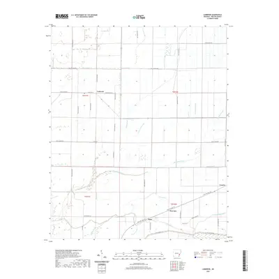
2020 Map of Lambrook
USGS Topo · Published 2020About this map
Lambrook anchors this Phillips County landscape, where a dense network of bayous and sloughs defines the agricultural character of the Arkansas Delta. The southern portion of the quadrangle is marked by the presence of Ratio and Mary Spur, connected by the Delta Heritage Trail which follows an established corridor across the flatlands. This modern survey illustrates how water management shapes the region, with named drainage features like Humphrey Slough and Govan Slough weaving through the rectangular grid of local sections. The intricate hydrology of the area is further evidenced by the winding courses of Bear Bayou and Yellow Bank Bayou, which contrast with the straight lines of Phillips County roads such as Phillips Road 516 and State Highway 20. These water bodies and trails provide essential landmarks for researchers tracing the development of Delta settlements like Countiss.
Find a feature on this map
44 named features on this map. Tap any name to fly to it.
Don’t see what you’re looking for? This feature index may not catch every label — zoom into the map to look around manually.
Map Details
Editions of this 2020 Lambrook Map
This is the sole edition of this map. No revisions or reprints were ever made.
Other maps of this area

1930 · Mellwood
USGS Topo · 1:62,500

1939 · Modoc
USGS Topo · 1:62,500

1939 · Indian Bay
USGS Topo · 1:62,500

1939 · Henrico
USGS Topo · 1:62,500

1939 · Mellwood
USGS Topo · 1:62,500

1948 · Helena
USGS Topo · 1:250,000

1948 · Modoc
USGS Topo · 1:62,500

1950 · Helena
USGS Topo · 1:250,000

1954 · Mellwood
USGS Topo · 1:62,500

1954 · Indian Bay
USGS Topo · 1:62,500