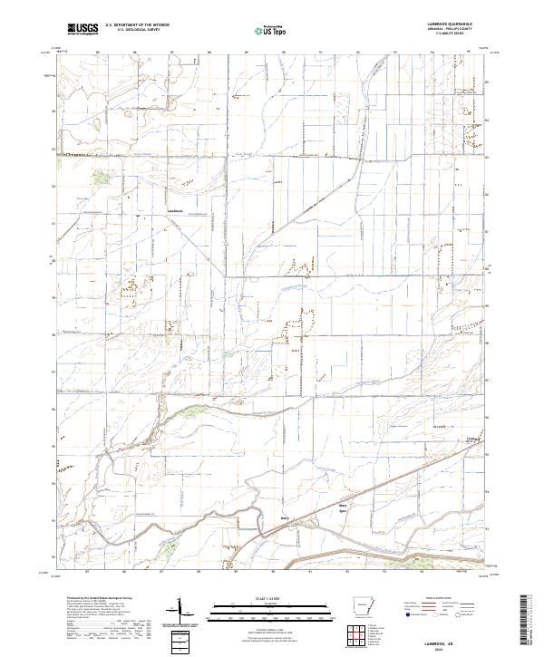
2024 Map of Lambrook
USGS Topo · Published 2024About this map
Lambrook and the surrounding Phillips County landscape are defined by an intricate network of drainage and delta hydrography, where the natural flow of bayous and sloughs meets a rigid grid of agricultural roads. Small settlements like Ratio, Mary Spur, and Countiss are situated along the south and east, connected by routes such as State Hwy 20 and the Delta Heritage Trl. The terrain is characterized by winding watercourses, including Jessie Slough in the north and the complex branching of Bear Bayou and Middle Bayou to the southwest.
Find a feature on this map
44 named features on this map. Tap any name to fly to it.
Don’t see what you’re looking for? This feature index may not catch every label — zoom into the map to look around manually.
Map Details
Editions of this 2024 Lambrook Map
This is the sole edition of this map. No revisions or reprints were ever made.
Other maps of this area

1930 · Mellwood
USGS Topo · 1:62,500

1939 · Modoc
USGS Topo · 1:62,500

1939 · Indian Bay
USGS Topo · 1:62,500

1939 · Henrico
USGS Topo · 1:62,500

1939 · Mellwood
USGS Topo · 1:62,500

1948 · Helena
USGS Topo · 1:250,000

1948 · Modoc
USGS Topo · 1:62,500

1950 · Helena
USGS Topo · 1:250,000

1954 · Mellwood
USGS Topo · 1:62,500

1954 · Indian Bay
USGS Topo · 1:62,500