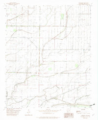
1982 Map of Lambrook
USGS Topo · Published 1982About this map
The low-lying Delta landscape of Phillips County is defined here by an intricate network of drainage and natural waterways. Lambrook serves as the primary settlement center, supported by local institutions like Lambrook Ch and Brooks Chapel. The terrain is dominated by the management of water, evidenced by the North Lambrook Ditch and South Lambrook Ditch which cut across the flat agricultural lands to channel runoff away from the fields and toward the bayous.
Find a feature on this map
23 named features on this map. Tap any name to fly to it.
Don’t see what you’re looking for? This feature index may not catch every label — zoom into the map to look around manually.
Map Details
Editions of this 1982 Lambrook Map
This is the sole edition of this map. No revisions or reprints were ever made.
Other maps of this area

1930 · Mellwood
USGS Topo · 1:62,500

1939 · Modoc
USGS Topo · 1:62,500

1939 · Indian Bay
USGS Topo · 1:62,500

1939 · Henrico
USGS Topo · 1:62,500

1939 · Mellwood
USGS Topo · 1:62,500

1948 · Helena
USGS Topo · 1:250,000

1948 · Modoc
USGS Topo · 1:62,500

1950 · Helena
USGS Topo · 1:250,000

1954 · Mellwood
USGS Topo · 1:62,500

1954 · Indian Bay
USGS Topo · 1:62,500