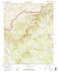
1965 Map of Lambsburg
USGS Topo · Published 1978About this map
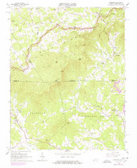
Blue Ridge summits dominate the border between Virginia and North Carolina on this survey, where the Blue Ridge Parkway winds along the crest of the escarpment. The settlement of Lambsburg sits nestled at the foot of the mountains on the Virginia side, served by the Lambsburg Sch and nearby Chestnut Grove Ch. The terrain falls away sharply toward the south, where the headwaters of the Fisher River and Little Fisher River drain into Surry County.
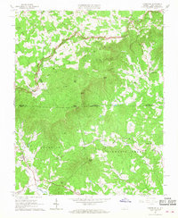
Find a feature on this map
59 named features on this map. Tap any name to fly to it.
Don’t see what you’re looking for? This feature index may not catch every label — zoom into the map to look around manually.
Map Details
Editions of this 1965 Lambsburg Map
Other maps of this area

1889 · Hillsville
USGS Topo · 1:125,000

1891 · Yadkinville
USGS Topo · 1:125,000

1892 · Hillsville
USGS Topo · 1:125,000

1893 · Yadkinville
USGS Topo · 1:125,000

1896 · Hillsville
USGS Topo · 1:125,000

1931 · Galax
USGS Topo · 1:48,000

1933 · Galax
USGS Topo · 1:62,500

1953 · Winston-Salem
USGS Topo · 1:250,000

1955 · Winston-Salem
USGS Topo · 1:250,000

1957 · Mount Airy
USGS Topo · 1:62,500