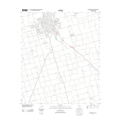
2012 Map of Lamesa South
USGS Topo · Published 2012About this map
Lamesa occupies the northern reaches of this High Plains landscape, where a dense grid of residential streets and avenues transitions into a sprawling agricultural and industrial periphery. The city’s infrastructure is anchored by prominent thoroughfares such as N Main Ave and Industrial Dr, reflecting its role as a regional center for commerce and petroleum production. To the west, the Lamesa West Oil Field underscores the region's long-standing reliance on energy extraction, while the Lamesa Municipal Airport sits on the northeastern outskirts. Moving south, the terrain becomes a patchwork of rural county roads, connecting smaller named locales such as Los Ybanez and the distant settlement of Fivemile. This 2012 survey illustrates the geometric precision of the Texas Panhandle's rural road system, where corridors like Co Road J and Co Road I partition the land into expansive agricultural blocks.
Find a feature on this map
93 named features on this map. Tap any name to fly to it.
Don’t see what you’re looking for? This feature index may not catch every label — zoom into the map to look around manually.
Map Details
Editions of this 2012 Lamesa South Map
This is the sole edition of this map. No revisions or reprints were ever made.
Other maps of this area

1954 · Hobbs
USGS Topo · 1:250,000

1954 · Big Spring
USGS Topo · 1:250,000

1958 · Big Spring
USGS Topo · 1:250,000

1958 · Hobbs
USGS Topo · 1:250,000

1968 · Lamesa North
USGS Topo · 1:24,000

1968 · Hancock
USGS Topo · 1:24,000

1969 · Punkin Center
USGS Topo · 1:24,000

1970 · Patricia
USGS Topo · 1:24,000

1970 · Lamesa South
USGS Topo · 1:24,000

1970 · Key
USGS Topo · 1:24,000