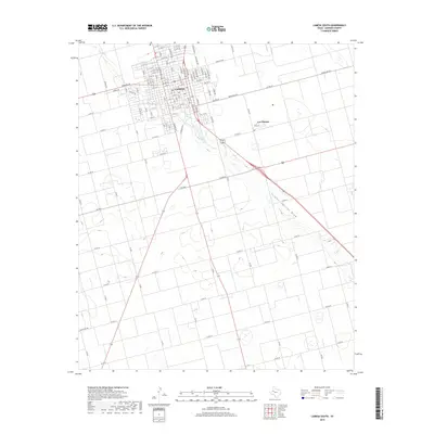
2019 Map of Lamesa South
USGS Topo · Published 2019About this map
The town of Lamesa serves as the focal point of this West Texas landscape, where a dense grid of residential and commercial streets gives way to the vast agricultural surroundings of Dawson County. The southern expansion of the community is marked by numbered streets ranging from N 19th St down to S 15th St, illustrating the town's organized growth. Southeast of the main hub lies the small incorporated enclave of Los Ybanez, situated along Main St. The terrain is defined by the prominent Sulphur Springs Draw, which meanders across the southeastern portion of the map. This geographic feature historically influenced the drainage and settlement patterns of the high plains, providing a stark contrast to the straight-line geometry of the local ranch and county road network that partitions the land.
Find a feature on this map
102 named features on this map. Tap any name to fly to it.
Don’t see what you’re looking for? This feature index may not catch every label — zoom into the map to look around manually.
Map Details
Editions of this 2019 Lamesa South Map
This is the sole edition of this map. No revisions or reprints were ever made.
Other maps of this area

1954 · Hobbs
USGS Topo · 1:250,000

1954 · Big Spring
USGS Topo · 1:250,000

1958 · Big Spring
USGS Topo · 1:250,000

1958 · Hobbs
USGS Topo · 1:250,000

1968 · Lamesa North
USGS Topo · 1:24,000

1968 · Hancock
USGS Topo · 1:24,000

1969 · Punkin Center
USGS Topo · 1:24,000

1970 · Patricia
USGS Topo · 1:24,000

1970 · Lamesa South
USGS Topo · 1:24,000

1970 · Key
USGS Topo · 1:24,000