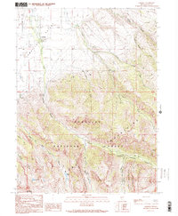
1990 Map of Lamoille
USGS Topo · Published 1991About this map
The small community of Lamoille sits at the foot of the Humboldt Mountains, where the Lamoille Valley meets the dramatic elevation of the Ruby Mountains Wilderness. This 1990 survey captures a landscape defined by sharp glacial carving and alpine hydrology, featuring high-altitude water bodies like Griswold Lake and Seitz Lake. The drainage network is complex, with Lamoille Creek, Talbot Creek, and Thomas Canyon Creek cutting through the terrain. Evidence of local infrastructure and recreation is scattered throughout, from the Cemetery and FS Station in the valley to the Power House Picnic Area Gaging Sta and Thomas Canyon Campground located deeper within the Humboldt National Forest. Traces of local industry appear in the form of a Borrow Pit and Quarry near the base of the mountains, illustrating the intersection of residential settlement and the surrounding wilderness.
Find a feature on this map
32 named features on this map. Tap any name to fly to it.
Don’t see what you’re looking for? This feature index may not catch every label — zoom into the map to look around manually.
Map Details
Editions of this 1990 Lamoille Map
2 editions found
Other maps of this area

1935 · Halleck
USGS Topo · 1:125,000

1955 · Elko
USGS Topo · 1:250,000

1958 · Elko
USGS Topo · 1:250,000

1962 · Elko
USGS Topo · 1:250,000

1962 · Boyd Reservoir
USGS Topo · 1:24,000

1962 · Lee
USGS Topo · 1:62,500

1962 · Lamoille
USGS Topo · 1:62,500

1965 · Elko
USGS Topo · 1:250,000
1970 · Soldier Peak
USGS Topo · 1:24,000
1971 · Halleck SW
USGS Topo · 1:24,000