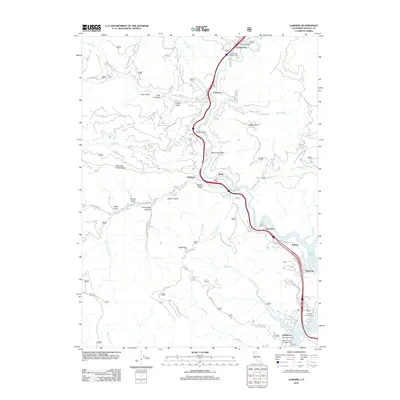
2012 Map of Lamoine
USGS Topo · Published 2012About this map
The Sacramento River carves a deep path through northern California in this 2012 survey, defining the corridor for infrastructure and settlement. Small communities and recreational sites like Pollard Flat and Vollmers are concentrated along the riverbanks, where the topography levels enough to support the passage of modern transit. Further south, the map reveals the upper reaches of Shasta Lake, where the river's flow meets the reservoir. This intersection has fostered several shoreline communities, including Lakeshore and Lakehead, alongside developed sites like Antlers Campground.
Find a feature on this map
57 named features on this map. Tap any name to fly to it.
Don’t see what you’re looking for? This feature index may not catch every label — zoom into the map to look around manually.
Map Details
Editions of this 2012 Lamoine Map
This is the sole edition of this map. No revisions or reprints were ever made.
Other maps of this area

1886 · Shasta
USGS Topo · 1:250,000

1890 · Red Bluff
USGS Topo · 1:250,000

1894 · Red Bluff
USGS Topo · 1:250,000

1894 · Shasta
USGS Topo · 1:250,000

1901 · Redding
USGS Topo · 1:125,000

1913 · Weaverville
USGS Topo · 1:125,000

1923 · Sawyers Bar
USGS Topo · 1:125,000

1931 · Etna
USGS Topo · 1:96,000

1934 · Etna
USGS Topo · 1:125,000

1935 · Dunsmuir
USGS Topo · 1:125,000