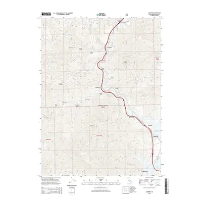
2015 Map of Lamoine
USGS Topo · Published 2015About this map
The Sacramento River carves a deep path through the Shasta National Forest in this 2015 study, documenting a string of settlements tied to the river and the interstate corridor. From Pollard Flat in the north down to Lakeshore, the map reveals a landscape where steep ridges like Mosquito Creek Ridge and French Ridge overlook narrow valleys and the northern reaches of Shasta Lake. This modern survey is particularly useful for tracking the contemporary layout of small communities such as Lamoine, Delta, and Vollmers, as well as the intricate drainage network of creeks like Slate Cr and Dog Cr. The intersection of industrial-era place names, such as Coal Pit Gulch and Dam Gulch, with modern recreation hubs at Lakehead and Riverview illustrates the area's transition from resource extraction to its role as a gateway for the surrounding wilderness.
Find a feature on this map
48 named features on this map. Tap any name to fly to it.
Don’t see what you’re looking for? This feature index may not catch every label — zoom into the map to look around manually.
Map Details
Editions of this 2015 Lamoine Map
This is the sole edition of this map. No revisions or reprints were ever made.
Other maps of this area

1886 · Shasta
USGS Topo · 1:250,000

1890 · Red Bluff
USGS Topo · 1:250,000

1894 · Red Bluff
USGS Topo · 1:250,000

1894 · Shasta
USGS Topo · 1:250,000

1901 · Redding
USGS Topo · 1:125,000

1913 · Weaverville
USGS Topo · 1:125,000

1923 · Sawyers Bar
USGS Topo · 1:125,000

1931 · Etna
USGS Topo · 1:96,000

1934 · Etna
USGS Topo · 1:125,000

1935 · Dunsmuir
USGS Topo · 1:125,000